Property Image Coming Soon

Liberty Pines
56 Creek St,
Wrentham,
MA
02093
2 Weeks Ago
Favorites
Liberty Pines
Favorites
Check Back Soon for Upcoming Availability
| Beds | Baths | Average SF | Availability |
|---|---|---|---|
| Studio Studio 0 Br | 1 Bath 1 Bath 1 Ba | — | Not Available |
| 1 Bedroom 1 Bedroom 1 Br | 1 Bath 1 Bath 1 Ba | 1,000 SF | Not Available |
About Liberty Pines
Discover your new place at Liberty Pines. The 56 Creek St. location in the 495 South neighborhood of Wrentham is convenient to everything. The professional leasing team is excited to help you find your new place. At Liberty Pines you're home.
Liberty Pines is an apartment community located in Norfolk County and the 02093 ZIP Code. This area is served by the Wrentham attendance zone.
Fees and Policies
Details
Property Information
-
Built in 1983
-
58 units/2 stories
Location
Get Directions
495-South is a large area surrounding Interstate 495 about 20 miles south of Boston. This suburban town features peaceful neighborhoods nestled in forested areas paired with commercial developments. Renters have the choice of moderately priced to luxury apartments, condos, and single-family homes. An abundance of shopping and dining choices are scattered along the town’s major thoroughfares. Ponds, creeks, and large natural areas like Franklin State Forest and DelCarte Conservation Area provide relaxing outdoor activities. Residents have access to big-city amenities by driving a bit north into Boston, and the eclectic downtown districts of Worcester and Framingham are situated outside of the western and eastern corners of town.
Learn more about living in 495-SouthBelow are rent ranges for similar nearby apartments
Education
| Colleges & Universities | Distance | ||
|---|---|---|---|
| Colleges & Universities | Distance | ||
| Drive: | 21 min | 13.1 mi | |
| Drive: | 33 min | 17.6 mi | |
| Drive: | 32 min | 19.6 mi | |
| Drive: | 34 min | 21.3 mi |
Liberty Pines is within 21 minutes or 13.1 miles from Wheaton College, Norton. It is also near C.C. of Rhode Island, Flanagan and Stonehill College.
Schools


Public Elementary School
Grades PK-3
582 Students
Attendance Zone
Public Elementary School
Grades 4-6
369 Students
Attendance Zone
Public Middle School
Grades 7-8
670 Students
Attendance Zone
Public High School
Grades 9-12
1,142 Students
Attendance Zone
Private Elementary, Middle & High School
Grades PK-12
209 Students
Nearby
Private Elementary & Middle School
Grades PK-8
157 Students
Nearby
School data provided by
 The GreatSchools Rating helps parents compare schools within a state based on a variety of school quality indicators and provides a helpful picture of how effectively each school serves all of its students. Ratings are on a scale of 1 (below average) to 10 (above average) and can include test scores, college readiness, academic progress, advanced courses, equity, discipline and attendance data. We also advise parents to visit schools, consider other information on school performance and programs, and consider family needs as part of the school selection process.
View GreatSchools Rating Methodology
View GreatSchools Rating Methodology
Transportation options available in Wrentham include Mattapan Station, located 21.9 miles from Liberty Pines. Liberty Pines is near Rhode Island Tf Green International, located 32.9 miles or 49 minutes away, and General Edward Lawrence Logan International, located 34.8 miles or 52 minutes away.
| Transit / Subway | Distance | ||
|---|---|---|---|
| Transit / Subway | Distance | ||
|
|
Drive: | 34 min | 21.9 mi |
|
|
Drive: | 35 min | 22.3 mi |
|
|
Drive: | 38 min | 24.3 mi |
|
|
Drive: | 39 min | 24.8 mi |
|
|
Drive: | 39 min | 25.0 mi |
| Commuter Rail | Distance | ||
|---|---|---|---|
| Commuter Rail | Distance | ||
|
|
Drive: | 8 min | 4.0 mi |
|
|
Drive: | 11 min | 5.6 mi |
|
|
Drive: | 11 min | 5.9 mi |
|
|
Drive: | 13 min | 8.5 mi |
|
|
Drive: | 18 min | 10.3 mi |
| Airports | Distance | ||
|---|---|---|---|
| Airports | Distance | ||
|
Rhode Island Tf Green International
|
Drive: | 49 min | 32.9 mi |
|
General Edward Lawrence Logan International
|
Drive: | 52 min | 34.8 mi |
Time and distance from Liberty Pines.
| Shopping Centers | Distance | ||
|---|---|---|---|
| Shopping Centers | Distance | ||
| Drive: | 3 min | 1.3 mi | |
| Drive: | 5 min | 2.3 mi | |
| Drive: | 7 min | 2.8 mi |
Liberty Pines has 3 shopping centers within 2.8 miles, which is about a 7-minute drive. The miles and minutes will be for the farthest away property.
| Parks and Recreation | Distance | ||
|---|---|---|---|
| Parks and Recreation | Distance | ||
|
Mass Audubon's Stony Brook Wildlife Sanctuary
|
Drive: | 9 min | 4.7 mi |
|
F. Gilbert Hills State Forest
|
Drive: | 12 min | 5.3 mi |
|
North Attleboro National Fish Hatchery
|
Drive: | 15 min | 7.2 mi |
|
Mass Audubon's Moose Hill Wildlife Sanctuary
|
Drive: | 19 min | 10.9 mi |
|
Borderland State Park
|
Drive: | 23 min | 11.6 mi |
Liberty Pines has 5 parks within 11.6 miles, including Mass Audubon's Stony Brook Wildlife Sanctuary, F. Gilbert Hills State Forest, and North Attleboro National Fish Hatchery.
| Hospitals | Distance | ||
|---|---|---|---|
| Hospitals | Distance | ||
| Drive: | 20 min | 10.5 mi | |
| Drive: | 20 min | 10.7 mi | |
| Drive: | 21 min | 11.2 mi |
Liberty Pines has 3 hospitals within 11.2 miles, the nearest is Sturdy Memorial Hospital which is 10.5 miles away and a 20 minute drive.
| Military Bases | Distance | ||
|---|---|---|---|
| Military Bases | Distance | ||
| Drive: | 36 min | 19.0 mi |
Liberty Pines is 19.0 miles and a 36 minute drive from US Military Reservation.
You May Also Like
What neighborhood is the property located in?
Liberty Pines is in the city of Wrentham. Here you’ll find three shopping centers within 2.8 miles of the property.Five parks are within 11.6 miles, including Mass Audubon's Stony Brook Wildlife Sanctuary, F. Gilbert Hills State Forest, and North Attleboro National Fish Hatchery.
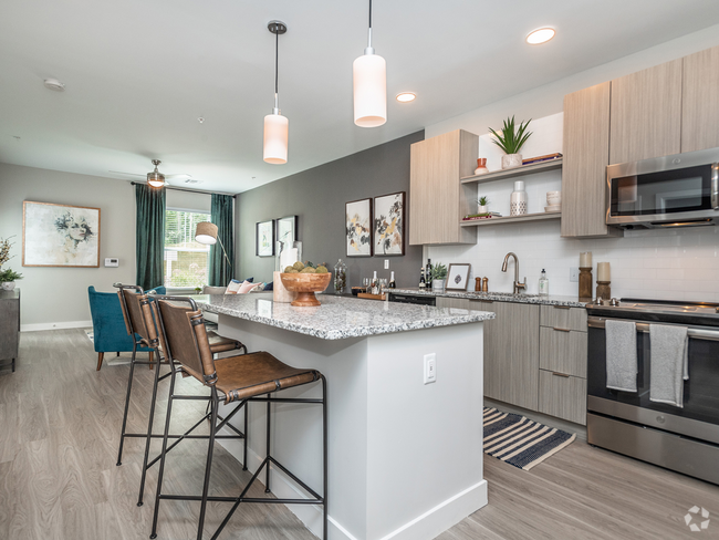
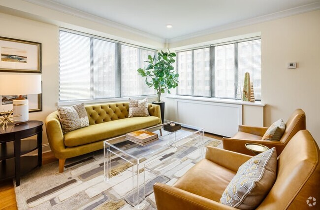
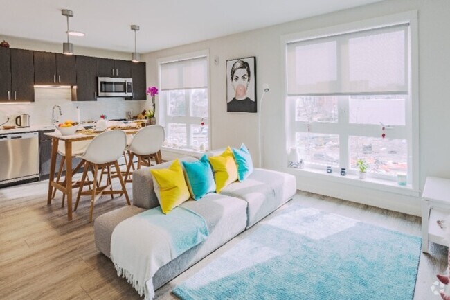
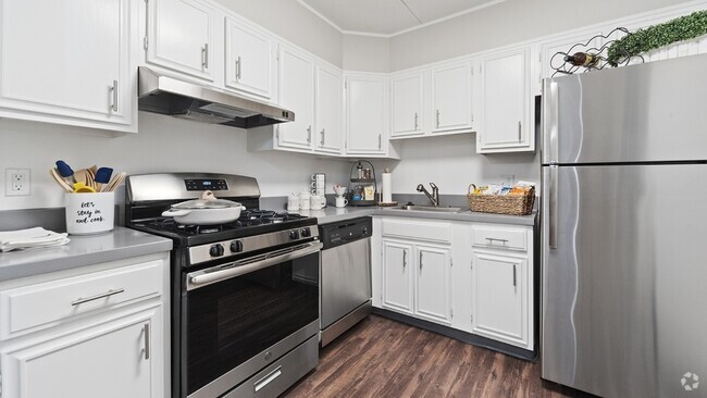
Similar Rentals Nearby


What Are Walk Score®, Transit Score®, and Bike Score® Ratings?
Walk Score® measures the walkability of any address. Transit Score® measures access to public transit. Bike Score® measures the bikeability of any address.
What is a Sound Score Rating?
A Sound Score Rating aggregates noise caused by vehicle traffic, airplane traffic and local sources
Responded To This Review