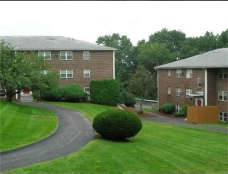
253 Boston Post Rd E
Marlborough, MA 01752
-
Bedrooms
2
-
Bathrooms
1
-
Square Feet
--
-
Available
Available Mar 1
About This Home
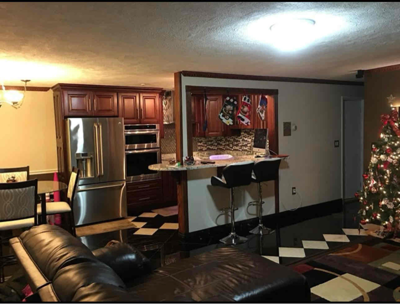
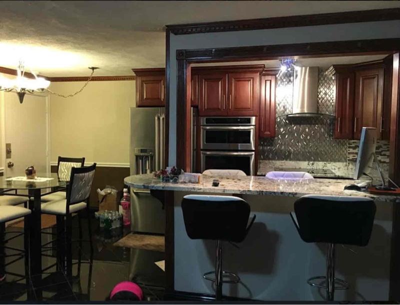
Property Id: 1758902 Heat and hot water included. Modern two bedroom condo. Large rooms, eat in kitchen, parking for two cars. To view please text Wally RE Agent .
253 Boston Post Rd E is a condo located in Middlesex County and the 01752 ZIP Code.
Contact
- Listed by Walter Aldrich
- Phone Number (508) 450-0620
- Contact
-
Source

Just west of Boston and East of Worcester sits Metro West, a region that houses a group of towns and cities with significant historical backgrounds. A total of 19 municipalities make up the core of this community, but other municipalities are considered to be a part of the Interstate 495/Metro West Corridor.
Learn more about living in Metro West| Colleges & Universities | Distance | ||
|---|---|---|---|
| Colleges & Universities | Distance | ||
| Drive: | 16 min | 7.6 mi | |
| Drive: | 27 min | 14.6 mi | |
| Drive: | 31 min | 15.7 mi | |
| Drive: | 25 min | 17.5 mi |
Transportation options available in Marlborough include Riverside Station, located 17.1 miles from 253 Boston Post Rd E Unit 10. 253 Boston Post Rd E Unit 10 is near Worcester Regional, located 24.0 miles or 36 minutes away, and General Edward Lawrence Logan International, located 33.7 miles or 51 minutes away.
| Transit / Subway | Distance | ||
|---|---|---|---|
| Transit / Subway | Distance | ||
|
|
Drive: | 31 min | 17.1 mi |
|
|
Drive: | 31 min | 17.4 mi |
|
|
Drive: | 32 min | 18.1 mi |
|
|
Drive: | 34 min | 19.7 mi |
|
|
Drive: | 35 min | 19.9 mi |
| Commuter Rail | Distance | ||
|---|---|---|---|
| Commuter Rail | Distance | ||
|
|
Drive: | 15 min | 6.4 mi |
|
|
Drive: | 20 min | 9.3 mi |
|
|
Drive: | 20 min | 9.4 mi |
|
|
Drive: | 25 min | 10.2 mi |
|
|
Drive: | 23 min | 10.6 mi |
| Airports | Distance | ||
|---|---|---|---|
| Airports | Distance | ||
|
Worcester Regional
|
Drive: | 36 min | 24.0 mi |
|
General Edward Lawrence Logan International
|
Drive: | 51 min | 33.7 mi |
Time and distance from 253 Boston Post Rd E Unit 10.
| Shopping Centers | Distance | ||
|---|---|---|---|
| Shopping Centers | Distance | ||
| Walk: | 10 min | 0.5 mi | |
| Walk: | 11 min | 0.6 mi | |
| Walk: | 13 min | 0.7 mi |
| Parks and Recreation | Distance | ||
|---|---|---|---|
| Parks and Recreation | Distance | ||
|
Memorial Forest
|
Drive: | 8 min | 3.9 mi |
|
Felton Conservation Area
|
Drive: | 8 min | 4.3 mi |
|
Hop Brook Natural Area
|
Drive: | 9 min | 4.6 mi |
|
Callahan State Park
|
Drive: | 12 min | 5.7 mi |
|
Nobscot Scout Reservation
|
Drive: | 10 min | 5.7 mi |
| Hospitals | Distance | ||
|---|---|---|---|
| Hospitals | Distance | ||
| Drive: | 4 min | 2.1 mi | |
| Drive: | 18 min | 8.6 mi |
| Military Bases | Distance | ||
|---|---|---|---|
| Military Bases | Distance | ||
| Drive: | 23 min | 12.1 mi |
You May Also Like
What Are Walk Score®, Transit Score®, and Bike Score® Ratings?
Walk Score® measures the walkability of any address. Transit Score® measures access to public transit. Bike Score® measures the bikeability of any address.
What is a Sound Score Rating?
A Sound Score Rating aggregates noise caused by vehicle traffic, airplane traffic and local sources

253 Boston Post Rd E
Marlborough, MA 01752