
Airo at South Bay
12530 Crenshaw Blvd,
Hawthorne, CA 90250
$2,350 - $3,775
Studio - 2 Beds
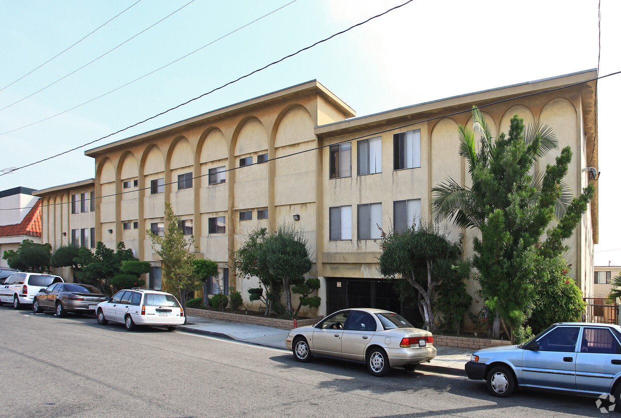
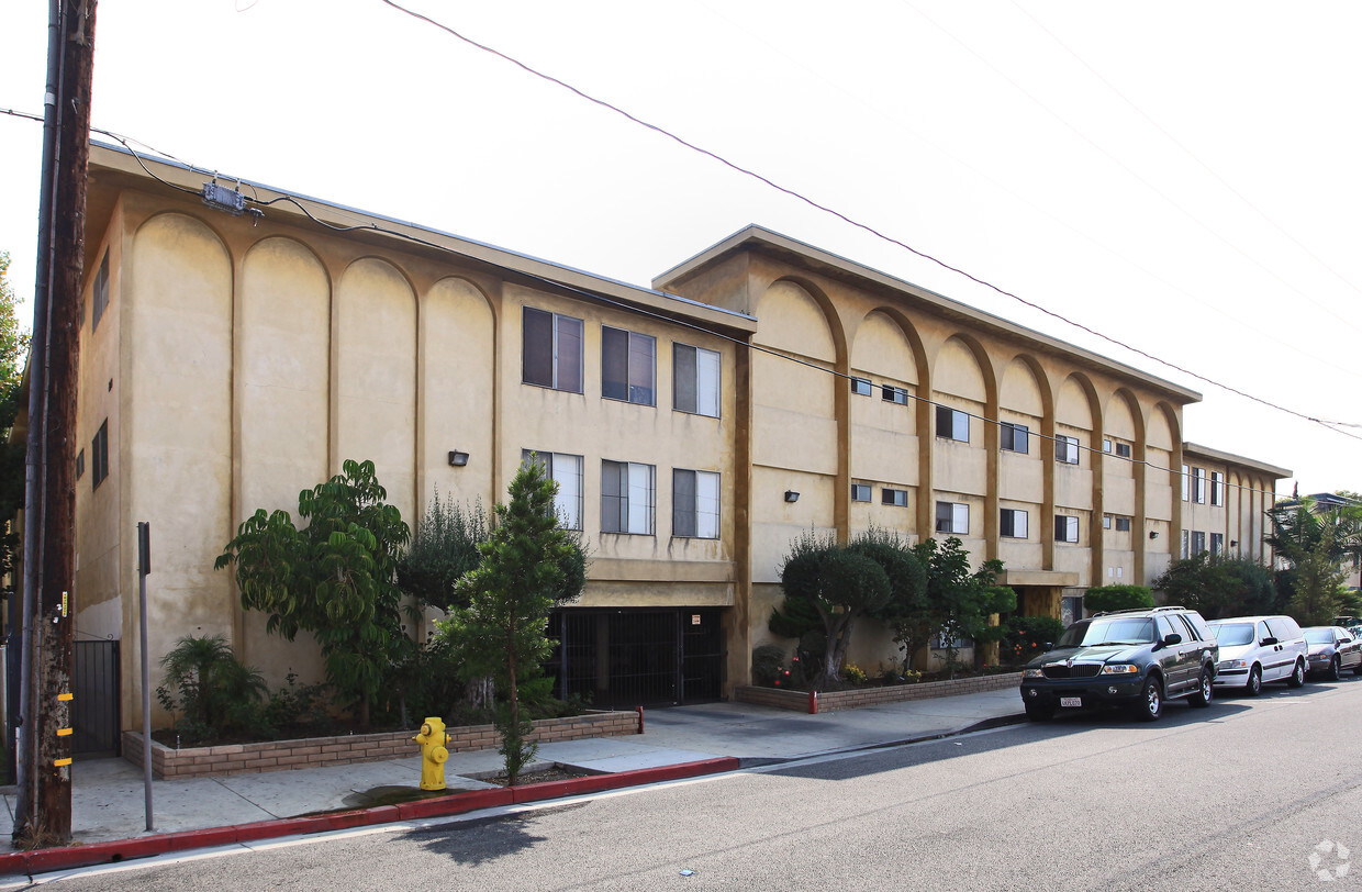

Experience Hawthorne living at Luna Park Apartments. The Roselle Ave location in the 90250 area of Hawthorne is a unique place to move. The leasing staff is waiting to show you all that this community has in store. Schedule a time to see the available floorplan options. So get a head start on your move. Contact or stop by Luna Park Apartments to check the availability and schedule a tour today!
Luna Park Apartments is an apartment community located in Los Angeles County and the 90250 ZIP Code. This area is served by the Hawthorne attendance zone.
High Speed Internet Access
Smoke Free
Heating
Oven
Welcome to Hawthorne, a South Bay city known for its aerospace industry and convenient location. Situated just five miles from Los Angeles International Airport, Hawthorne combines industrial heritage with modern innovation, highlighted by SpaceX's headquarters and manufacturing facilities. The rental market offers diverse housing options, from apartment communities to single-family homes, with current average rents ranging from $1,408 for studios to $2,403 for three-bedroom units. Despite modest year-over-year increases of 0.8-2%, rental rates remain lower compared to nearby coastal communities.
Residents appreciate the Mediterranean climate and proximity to Southern California attractions. The city features several parks, including Jim Thorpe Park, while the Hawthorne Plaza Transit Center provides public transportation connections throughout the region. Local landmarks include the Beach Boys Historic Landmark, marking an important piece of music history.
Learn more about living in Hawthorne| Colleges & Universities | Distance | ||
|---|---|---|---|
| Colleges & Universities | Distance | ||
| Drive: | 6 min | 3.2 mi | |
| Drive: | 6 min | 3.7 mi | |
| Drive: | 11 min | 7.0 mi | |
| Drive: | 13 min | 8.1 mi |


Transportation options available in Hawthorne include Crenshaw Station, located 1.6 miles from Luna Park Apartments. Luna Park Apartments is near Los Angeles International, located 6.1 miles or 11 minutes away, and Long Beach (Daugherty Field), located 15.3 miles or 23 minutes away.
| Transit / Subway | Distance | ||
|---|---|---|---|
| Transit / Subway | Distance | ||
|
|
Drive: | 3 min | 1.6 mi |
|
|
Drive: | 5 min | 3.1 mi |
|
|
Drive: | 6 min | 3.1 mi |
|
|
Drive: | 6 min | 3.2 mi |
|
|
Drive: | 7 min | 4.0 mi |
| Commuter Rail | Distance | ||
|---|---|---|---|
| Commuter Rail | Distance | ||
|
|
Drive: | 21 min | 15.3 mi |
|
|
Drive: | 23 min | 15.5 mi |
|
|
Drive: | 25 min | 17.3 mi |
|
|
Drive: | 28 min | 18.7 mi |
| Drive: | 25 min | 19.4 mi |
| Airports | Distance | ||
|---|---|---|---|
| Airports | Distance | ||
|
Los Angeles International
|
Drive: | 11 min | 6.1 mi |
|
Long Beach (Daugherty Field)
|
Drive: | 23 min | 15.3 mi |
Time and distance from Luna Park Apartments.
| Shopping Centers | Distance | ||
|---|---|---|---|
| Shopping Centers | Distance | ||
| Walk: | 3 min | 0.2 mi | |
| Walk: | 4 min | 0.2 mi | |
| Walk: | 15 min | 0.8 mi |
| Parks and Recreation | Distance | ||
|---|---|---|---|
| Parks and Recreation | Distance | ||
|
Dockweiler State Beach
|
Drive: | 11 min | 5.7 mi |
|
Madrona Marsh Preserve & Nature Center
|
Drive: | 13 min | 6.3 mi |
|
Watts Towers-Rodia State Park
|
Drive: | 11 min | 7.3 mi |
|
Watts Senior Center & Rose Garden
|
Drive: | 11 min | 7.7 mi |
|
Compton Creek Natural Park at George Washington Elementary
|
Drive: | 12 min | 8.3 mi |
| Hospitals | Distance | ||
|---|---|---|---|
| Hospitals | Distance | ||
| Drive: | 6 min | 2.7 mi | |
| Drive: | 8 min | 4.8 mi | |
| Drive: | 11 min | 6.3 mi |
| Military Bases | Distance | ||
|---|---|---|---|
| Military Bases | Distance | ||
| Drive: | 5 min | 2.7 mi |
What Are Walk Score®, Transit Score®, and Bike Score® Ratings?
Walk Score® measures the walkability of any address. Transit Score® measures access to public transit. Bike Score® measures the bikeability of any address.
What is a Sound Score Rating?
A Sound Score Rating aggregates noise caused by vehicle traffic, airplane traffic and local sources

12912 Roselle Ave
Hawthorne, CA 90250


