
Park West
3200-3200 Pleasant Grove Blvd,
Roseville, CA 95747
1-4 Beds $2,750 - $4,200

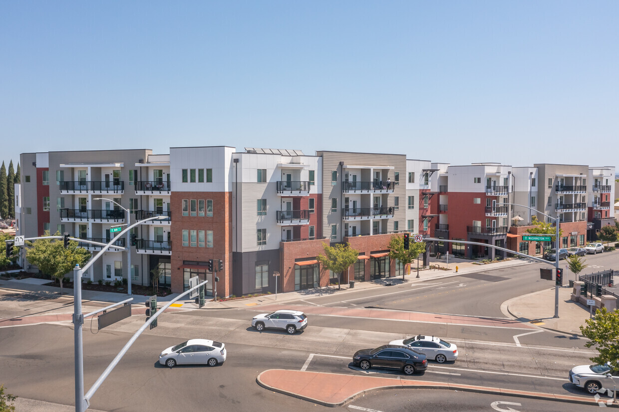
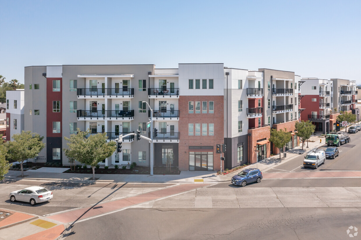
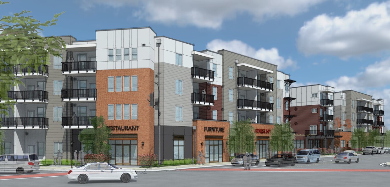
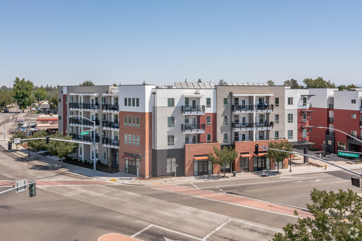
Check out Main Street Plaza in Roseville, CA. This community is located on Main St. in the Roseville Heights area of Roseville. The leasing team will assist you in finding your dream apartment. It's time to love where you live. Stop by for a visit today.
Main Street Plaza is an apartment community located in Placer County and the 95678 ZIP Code. This area is served by the Roseville City Elementary attendance zone.
Roseville Heights is the ideal neighborhood -- a leisurely walk from Downtown Roseville, filled with apartments and houses for rent, and minutes from the Alan S. Hart Freeway. Head three miles north to one of the area's favorite malls, Westfield Galleria, or directly west of the neighborhood to peruse Denio's Farmers Market & Swap Meet.
Visit two-acre Weber Park for a stroll before sunset or a game of pick-up basketball. If you appreciate both great food, old-time train depots, and model trains, go to the Pacific Street Cafe for all three. Irish fare reigns on the menu at the nearby Boxing Donkey Irish Pub & Restaurant, and the Union Roseville charms patrons with its great food, brick walls, video arcade, and artisan beers. Enjoy the tri-tip tacos and other deli delights at Roundhouse Deli.
Learn more about living in Roseville Heights| Colleges & Universities | Distance | ||
|---|---|---|---|
| Colleges & Universities | Distance | ||
| Drive: | 11 min | 5.8 mi | |
| Drive: | 18 min | 9.9 mi | |
| Drive: | 30 min | 15.5 mi | |
| Drive: | 28 min | 18.3 mi |


Transportation options available in Roseville include Watt/I-80, located 10.6 miles from Main Street Plaza. Main Street Plaza is near Sacramento International, located 25.8 miles or 36 minutes away.
| Transit / Subway | Distance | ||
|---|---|---|---|
| Transit / Subway | Distance | ||
|
|
Drive: | 15 min | 10.6 mi |
|
|
Drive: | 22 min | 11.4 mi |
|
|
Drive: | 23 min | 12.3 mi |
| Drive: | 17 min | 12.5 mi | |
|
|
Drive: | 25 min | 13.9 mi |
| Commuter Rail | Distance | ||
|---|---|---|---|
| Commuter Rail | Distance | ||
|
|
Walk: | 4 min | 0.3 mi |
|
|
Drive: | 9 min | 4.6 mi |
| Drive: | 23 min | 17.1 mi | |
|
|
Drive: | 23 min | 17.2 mi |
| Drive: | 26 min | 19.1 mi |
| Airports | Distance | ||
|---|---|---|---|
| Airports | Distance | ||
|
Sacramento International
|
Drive: | 36 min | 25.8 mi |
Time and distance from Main Street Plaza.
| Shopping Centers | Distance | ||
|---|---|---|---|
| Shopping Centers | Distance | ||
| Walk: | 7 min | 0.4 mi | |
| Walk: | 20 min | 1.0 mi | |
| Drive: | 3 min | 1.2 mi |
| Parks and Recreation | Distance | ||
|---|---|---|---|
| Parks and Recreation | Distance | ||
|
Mahany Park
|
Drive: | 7 min | 3.7 mi |
|
Sierra College Natural History Museum
|
Drive: | 10 min | 5.8 mi |
|
Mahan Park
|
Drive: | 11 min | 5.9 mi |
|
Luken Park
|
Drive: | 11 min | 6.0 mi |
|
Roccucci Park
|
Drive: | 13 min | 7.2 mi |
| Hospitals | Distance | ||
|---|---|---|---|
| Hospitals | Distance | ||
| Drive: | 6 min | 2.8 mi | |
| Drive: | 7 min | 2.9 mi | |
| Drive: | 15 min | 8.1 mi |
| Military Bases | Distance | ||
|---|---|---|---|
| Military Bases | Distance | ||
| Drive: | 26 min | 11.3 mi |
What Are Walk Score®, Transit Score®, and Bike Score® Ratings?
Walk Score® measures the walkability of any address. Transit Score® measures access to public transit. Bike Score® measures the bikeability of any address.
What is a Sound Score Rating?
A Sound Score Rating aggregates noise caused by vehicle traffic, airplane traffic and local sources
140 Main St
Roseville, CA 95678


