
$2,700 / Month
230 Smith St Unit AB
Brooklyn, NY 11231
2 Weeks Ago
Favorites
SMITH STREET

Favorites
Check Back Soon for Upcoming Availability
| Beds | Baths | Average SF |
|---|---|---|
| 2 Bedrooms 2 Bedrooms 2 Br | 1 Bath 1 Bath 1 Ba | — |
About This Property
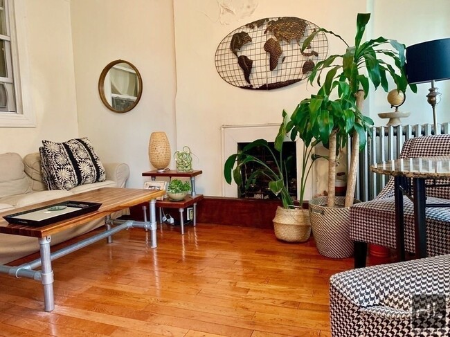
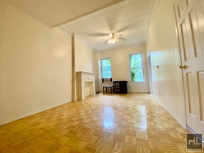
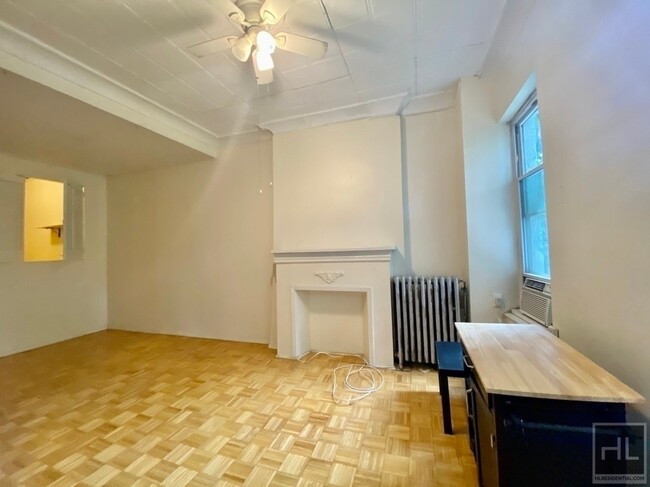
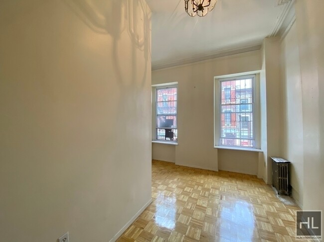
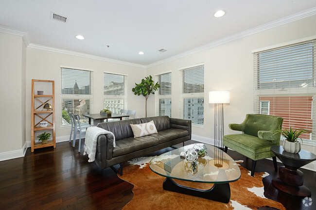
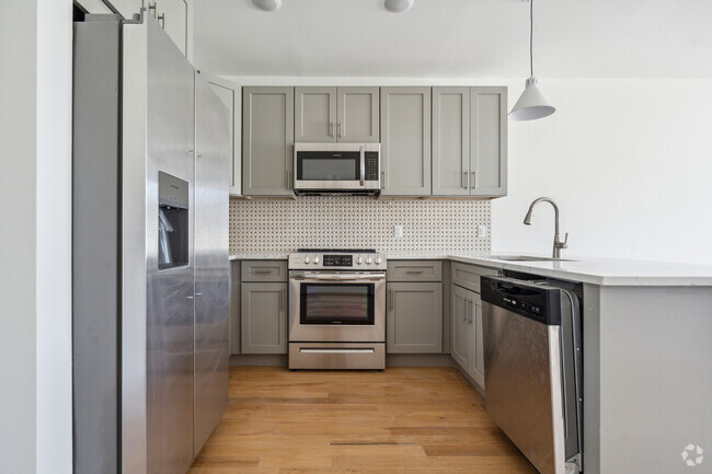
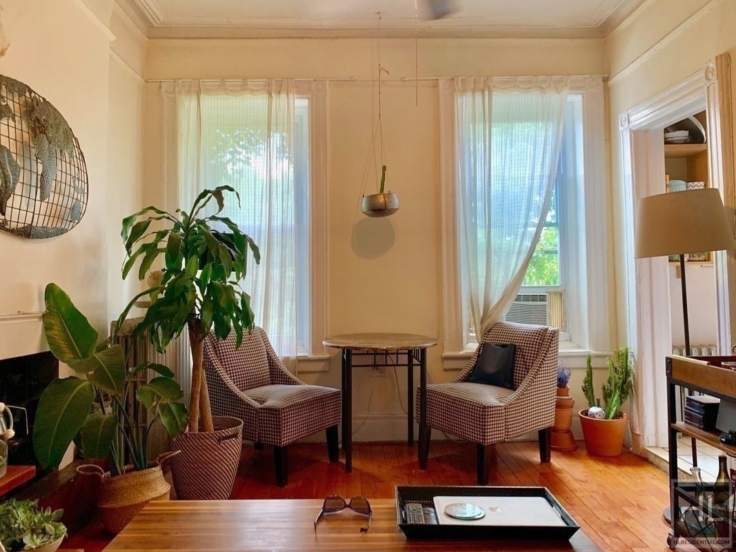
This lovely 2 bed (flex 3bd) apartment is located on the 2nd floor of a quiet walkup in the Boerum Hill/Cobble Hill border on Smith St. Close to many shops, laundry, subways, and many great restaurants, bars, and cafe's. Heat and hot water included.===Ref:821411===
SMITH STREET is an apartment community located in Kings County and the 11231 ZIP Code.
Location
Get Directions
Located in northwestern Brooklyn, just south of downtown, Boerum Hill offers the serenity of a suburb and the excitement of a bustling urban environment. Residents enjoy access to a host of eclectic restaurants and unique shops strewn along the main commercial thoroughfares—Smith Street and Atlantic Avenue.
In more residential parts of the neighborhood, historic brownstones and townhouses nestle up to quiet, tree-lined streets. Boerum Hill has two sister neighborhoods, Cobble Hill and Carol Gardens, which are both situated west of Boerum Hill. The iconic Barclays Center lies just east of Boerum Hill, hosting exciting events like Brooklyn Nets basketball games, boxing matches, and concerts. Convenient subway access makes getting around from Boerum Hill easy.
Learn more about living in Boerum HillBelow are rent ranges for similar nearby apartments
Education
| Colleges & Universities | Distance | ||
|---|---|---|---|
| Colleges & Universities | Distance | ||
| Walk: | 13 min | 0.7 mi | |
| Walk: | 13 min | 0.7 mi | |
| Walk: | 15 min | 0.8 mi | |
| Walk: | 19 min | 1.0 mi |
SMITH STREET is within 13 minutes or 0.7 mile from ASA College Brooklyn. It is also near Brooklyn Law School and St. Francis College.
Transportation options available in Brooklyn include Bergen Street (F,G Line), located 0.2 mile from SMITH STREET. SMITH STREET is near Laguardia, located 10.4 miles or 20 minutes away, and Newark Liberty International, located 15.0 miles or 26 minutes away.
| Transit / Subway | Distance | ||
|---|---|---|---|
| Transit / Subway | Distance | ||
|
|
Walk: | 4 min | 0.2 mi |
|
|
Walk: | 5 min | 0.3 mi |
|
|
Walk: | 12 min | 0.7 mi |
|
|
Walk: | 13 min | 0.7 mi |
|
|
Walk: | 13 min | 0.7 mi |
| Commuter Rail | Distance | ||
|---|---|---|---|
| Commuter Rail | Distance | ||
|
|
Drive: | 5 min | 1.4 mi |
|
|
Drive: | 8 min | 2.9 mi |
|
|
Drive: | 12 min | 4.1 mi |
|
|
Drive: | 12 min | 4.2 mi |
|
|
Drive: | 18 min | 6.8 mi |
| Airports | Distance | ||
|---|---|---|---|
| Airports | Distance | ||
|
Laguardia
|
Drive: | 20 min | 10.4 mi |
|
Newark Liberty International
|
Drive: | 26 min | 15.0 mi |
Time and distance from SMITH STREET.
| Shopping Centers | Distance | ||
|---|---|---|---|
| Shopping Centers | Distance | ||
| Walk: | 16 min | 0.9 mi | |
| Drive: | 4 min | 1.4 mi | |
| Drive: | 4 min | 1.6 mi |
SMITH STREET has 3 shopping centers within 1.6 miles, which is about a 4-minute walk. The miles and minutes will be for the farthest away property.
| Parks and Recreation | Distance | ||
|---|---|---|---|
| Parks and Recreation | Distance | ||
|
Cobble Hill Park
|
Walk: | 9 min | 0.5 mi |
|
Gowanus Canal
|
Walk: | 13 min | 0.7 mi |
|
Cadman Plaza Park
|
Drive: | 3 min | 1.2 mi |
|
Fort Greene Park
|
Drive: | 4 min | 1.4 mi |
|
Coffey Park
|
Drive: | 5 min | 1.5 mi |
SMITH STREET has 5 parks within 1.5 miles, including Cobble Hill Park, Gowanus Canal, and Cadman Plaza Park.
| Hospitals | Distance | ||
|---|---|---|---|
| Hospitals | Distance | ||
| Drive: | 4 min | 1.4 mi | |
| Drive: | 7 min | 2.4 mi | |
| Drive: | 10 min | 3.5 mi |
SMITH STREET has 3 hospitals within 3.5 miles, the nearest is Brooklyn Hospital Center - Downtown Campus which is 1.4 miles away and a 4 minute drive.
| Military Bases | Distance | ||
|---|---|---|---|
| Military Bases | Distance | ||
| Drive: | 11 min | 4.6 mi | |
| Drive: | 24 min | 12.4 mi |
SMITH STREET is 4.6 miles from Governors Island Support Center, and is convenient to other military bases, including Military Ocean Terminal.
You May Also Like
Similar Rentals Nearby


What Are Walk Score®, Transit Score®, and Bike Score® Ratings?
Walk Score® measures the walkability of any address. Transit Score® measures access to public transit. Bike Score® measures the bikeability of any address.
What is a Sound Score Rating?
A Sound Score Rating aggregates noise caused by vehicle traffic, airplane traffic and local sources
230 Smith St
Brooklyn, NY 11231