
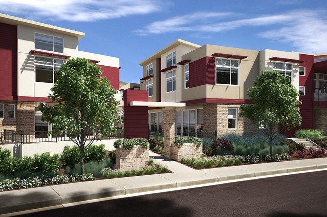
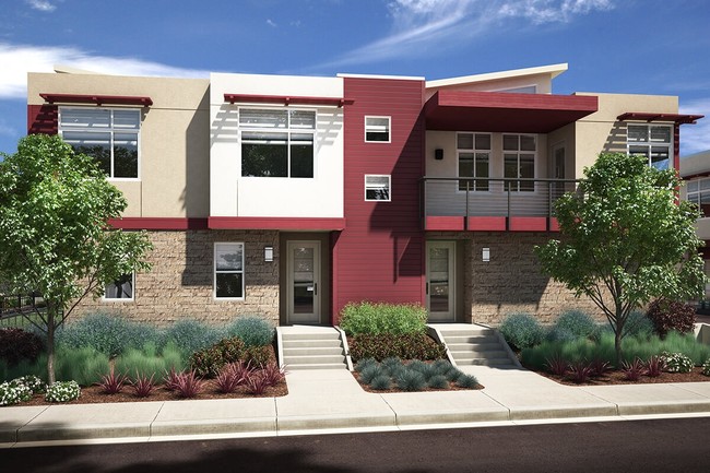

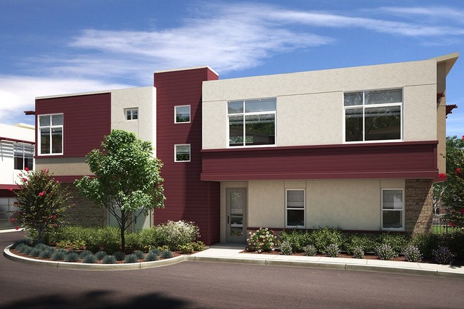
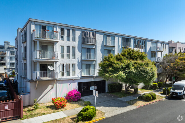
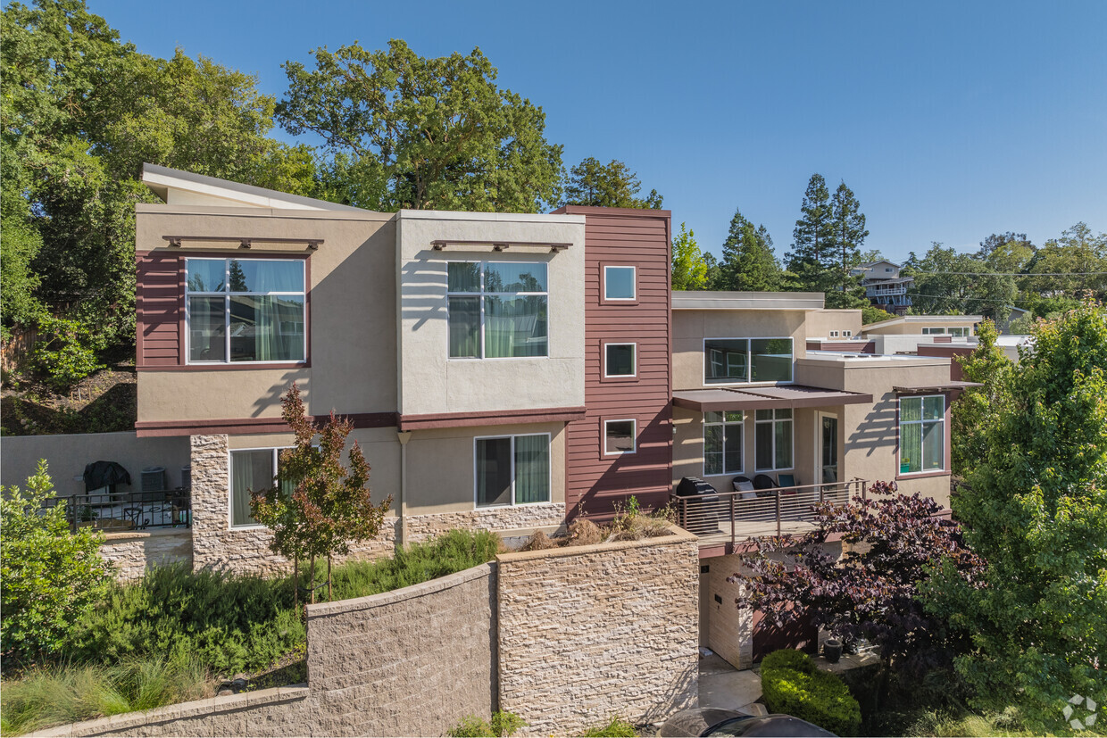
Stoneyridge Lane
310 Stoneyridge Ln,
Walnut Creek,
CA
94596
2 Weeks Ago
Favorites
Stoneyridge Lane
Favorites
Check Back Soon for Upcoming Availability
| Beds | Baths | Average SF | Availability |
|---|---|---|---|
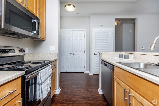
| 2 Bedrooms 2 Bedrooms 2 Br | 2 Baths 2 Baths 2 Ba | 1,378 SF | Not Available |
| 3 Bedrooms 3 Bedrooms 3 Br | 2.5 Baths 2.5 Baths 2.5 Ba | 1,996 SF | Not Available |
About Stoneyridge Lane
Find your new home at Stoneyridge Lane. The 310 Stoneyridge Ln. location in the 94596 neighborhood of Walnut Creek is perfectly situated for work or play. From pricing to features, the professional leasing staff will assist you in finding the perfect apartment. It's time to love where you live. Stop by for a visit today.
Stoneyridge Lane is an apartment community located in Contra Costa County and the 94596 ZIP Code. This area is served by the Walnut Creek Elementary attendance zone.
Fees and Policies
Details
Property Information
-
Built in 2018
-
21 units/2 stories
Location
Get Directions
Nestled about 25 miles east of San Francisco, Lower Lakewood is a lively residential area attracting renters looking for a peaceful place to establish roots in the Bay Area. Renters have the choice of a plethora of apartments in a variety of styles. While most of Lower Lakewood is residential, the neighborhood is immediately east of the heart of Walnut Creek. This downtown district is known for its premier shopping and dining choices along Main Street. Broadway Plaza, an outdoor mall featuring 80 shops and a variety of restaurants, is the crown jewel of the upscale shopping district. Outside of the buzzing shops of Downtown Walnut Creek, Lower Lakewood residents enjoy visiting community parks like Civic Park, and adventure seekers enjoy hiking along the Briones to Mount Diablo Regional Trail that eventually leads into the Diablo Foothills Regional Park.
Learn more about living in Lower LakewoodBelow are rent ranges for similar nearby apartments
Education
| Colleges & Universities | Distance | ||
|---|---|---|---|
| Colleges & Universities | Distance | ||
| Drive: | 16 min | 6.6 mi | |
| Drive: | 14 min | 6.9 mi | |
| Drive: | 24 min | 14.2 mi | |
| Drive: | 27 min | 17.9 mi |
Stoneyridge Lane is within 14 minutes or 6.9 miles from Diablo Valley, Pleasant Hill. It is also near Saint Marys Coll. of Calif. and UC Berkeley.
Schools


Public Elementary School
Grades K-5
364 Students
Nearby
Public Elementary School
Grades K-5
497 Students
Nearby
Public Elementary School
Grades K-5
403 Students
Attendance Zone
Public Middle School
Grades 6-8
985 Students
Attendance Zone
Public High School
Grades 9-12
1,571 Students
Attendance Zone
Private Elementary & Middle School
Grades K-8
302 Students
Nearby
Private Middle School
Grades 7
7 Students
Nearby
Private Middle & High School
Grades 8-12
Nearby
School data provided by
 The GreatSchools Rating helps parents compare schools within a state based on a variety of school quality indicators and provides a helpful picture of how effectively each school serves all of its students. Ratings are on a scale of 1 (below average) to 10 (above average) and can include test scores, college readiness, academic progress, advanced courses, equity, discipline and attendance data. We also advise parents to visit schools, consider other information on school performance and programs, and consider family needs as part of the school selection process.
View GreatSchools Rating Methodology
View GreatSchools Rating Methodology
Transportation options available in Walnut Creek include Walnut Creek Station, located 1.4 miles from Stoneyridge Lane. Stoneyridge Lane is near Metro Oakland International, located 24.0 miles or 34 minutes away, and San Francisco International, located 36.0 miles or 52 minutes away.
| Transit / Subway | Distance | ||
|---|---|---|---|
| Transit / Subway | Distance | ||
|
|
Drive: | 4 min | 1.4 mi |
|
|
Drive: | 5 min | 2.6 mi |
|
|
Drive: | 6 min | 4.0 mi |
|
|
Drive: | 13 min | 7.8 mi |
|
|
Drive: | 12 min | 8.1 mi |
| Commuter Rail | Distance | ||
|---|---|---|---|
| Commuter Rail | Distance | ||
|
|
Drive: | 18 min | 13.2 mi |
|
|
Drive: | 24 min | 15.4 mi |
|
|
Drive: | 23 min | 17.1 mi |
|
|
Drive: | 27 min | 19.0 mi |
|
|
Drive: | 29 min | 22.1 mi |
| Airports | Distance | ||
|---|---|---|---|
| Airports | Distance | ||
|
Metro Oakland International
|
Drive: | 34 min | 24.0 mi |
|
San Francisco International
|
Drive: | 52 min | 36.0 mi |
Time and distance from Stoneyridge Lane.
| Shopping Centers | Distance | ||
|---|---|---|---|
| Shopping Centers | Distance | ||
| Walk: | 7 min | 0.4 mi | |
| Walk: | 7 min | 0.4 mi | |
| Walk: | 8 min | 0.4 mi |
Stoneyridge Lane has 3 shopping centers within 0.4 mile, which is about a 8-minute walk. The miles and minutes will be for the farthest away property.
| Parks and Recreation | Distance | ||
|---|---|---|---|
| Parks and Recreation | Distance | ||
|
Howe Homestead Park
|
Walk: | 9 min | 0.5 mi |
|
Contra Costa Canal Regional Trail
|
Walk: | 10 min | 0.5 mi |
|
Butterfly Habitat Gardens
|
Walk: | 12 min | 0.7 mi |
|
Civic Park
|
Walk: | 12 min | 0.7 mi |
|
Lar Rieu Park
|
Walk: | 15 min | 0.8 mi |
Stoneyridge Lane has 5 parks within 0.8 mile, including Howe Homestead Park, Contra Costa Canal Regional Trail, and Butterfly Habitat Gardens.
| Hospitals | Distance | ||
|---|---|---|---|
| Hospitals | Distance | ||
| Walk: | 14 min | 0.7 mi | |
| Drive: | 4 min | 1.6 mi | |
| Drive: | 12 min | 8.3 mi |
Stoneyridge Lane has 3 hospitals within 8.3 miles, the nearest is Kaiser Foundation Hospital - Walnut Creek which is 0.7 mile away and a 14 minute walk.
You May Also Like
What neighborhood is the property located in?
Stoneyridge Lane is in Lower Lakewood in the city of Walnut Creek. Here you’ll find three shopping centers within 0.4 mile of the property. Five parks are within 0.8 mile, including Howe Homestead Park, Contra Costa Canal Regional Trail, and Butterfly Habitat Gardens.
Similar Rentals Nearby


What Are Walk Score®, Transit Score®, and Bike Score® Ratings?
Walk Score® measures the walkability of any address. Transit Score® measures access to public transit. Bike Score® measures the bikeability of any address.
What is a Sound Score Rating?
A Sound Score Rating aggregates noise caused by vehicle traffic, airplane traffic and local sources
310 Stoneyridge Ln
Walnut Creek, CA 94596
Responded To This Review