
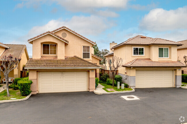
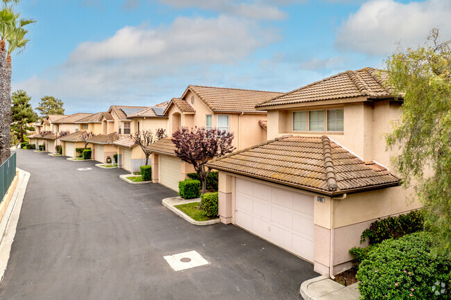
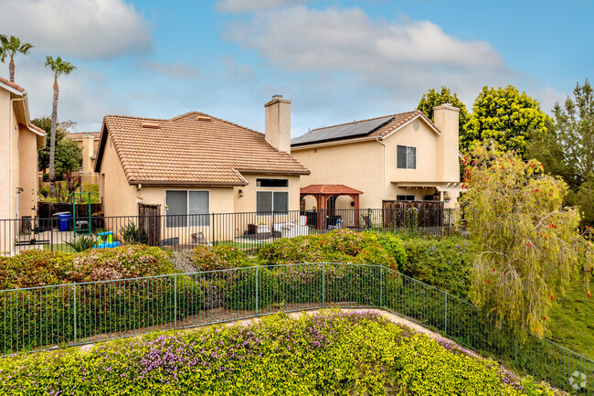
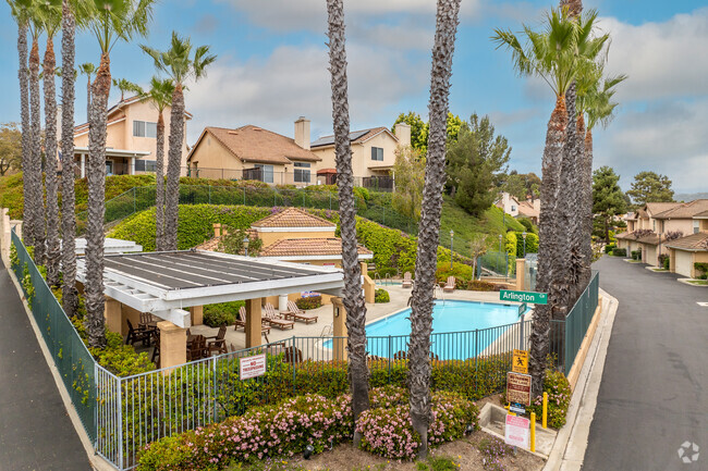
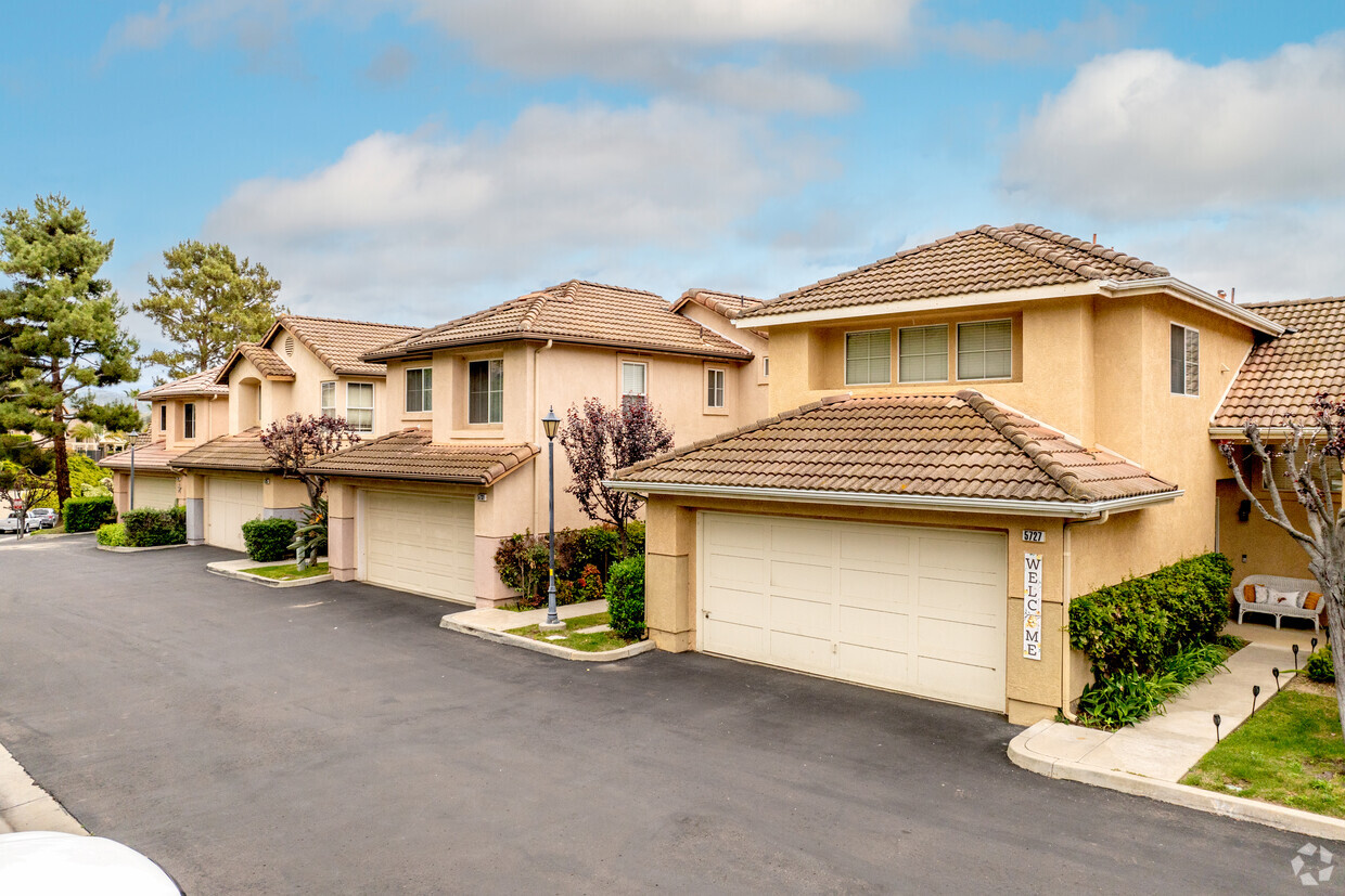
The Heights
31937 Del Cielo Este,
Bonsall,
CA
92003
2 Weeks Ago
Favorites
The Heights
Favorites
Check Back Soon for Upcoming Availability
| Beds | Baths | Average SF | Availability |
|---|---|---|---|
| 3 Bedrooms 3 Bedrooms 3 Br | 2.5 Baths 2.5 Baths 2.5 Ba | 1,352 SF | Not Available |
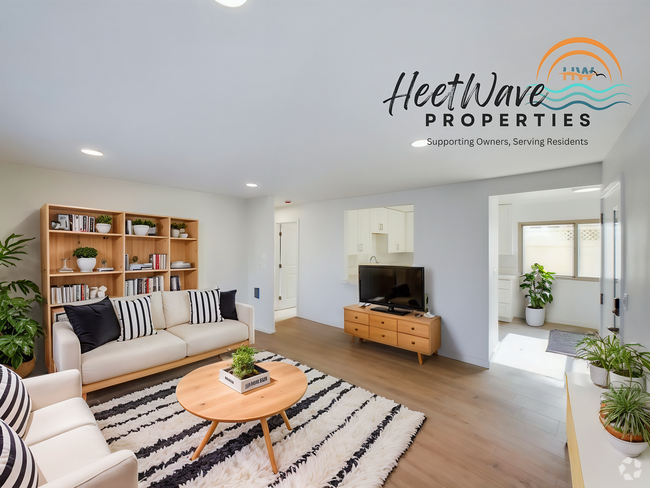
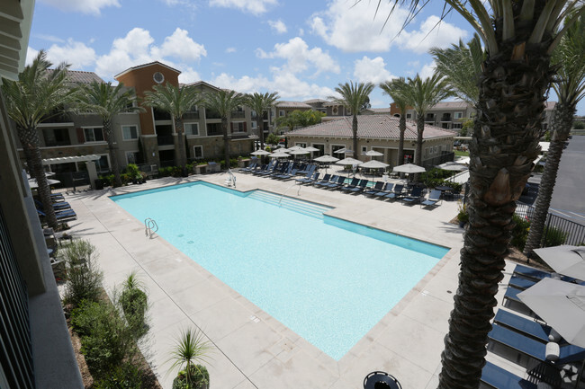
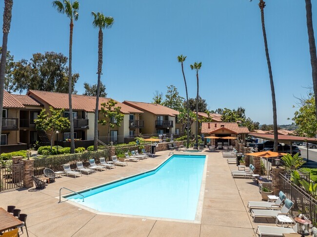
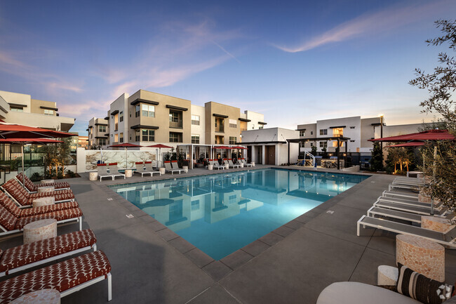
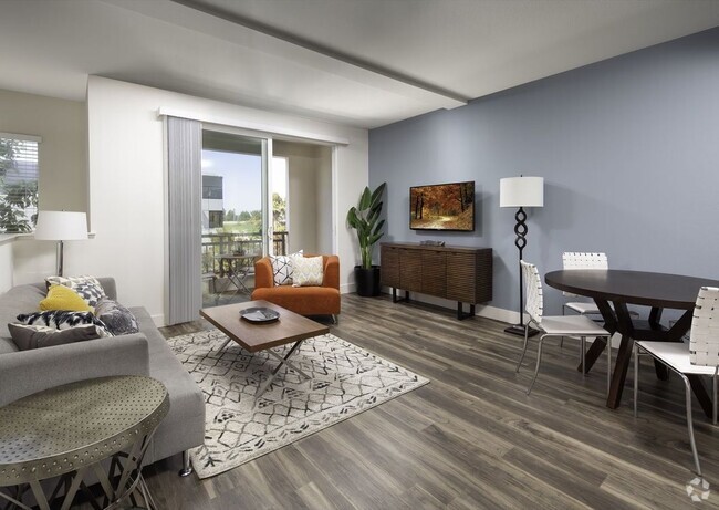
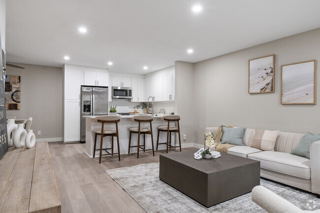
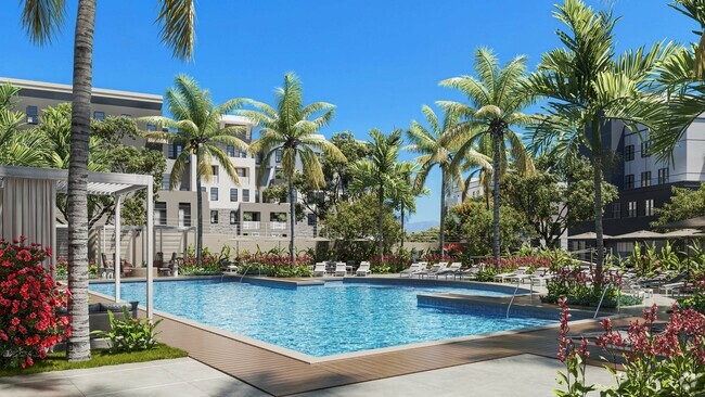
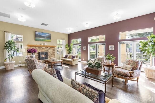
About The Heights
Experience Bonsall living at The Heights. In a convenient location on Del Cielo Este in Bonsall's 92003 Zip code, local residents can easily connect with a number of points of interest. From pricing to features, the professional leasing staff is ready to help you in finding your perfect fit. Schedule a time to check out the current floorplan options. Welcome to your new home at The Heights. Contact or drop by to check the availability and set up a tour today.
The Heights is an apartment community located in San Diego County and the 92003 ZIP Code. This area is served by the Bonsall Unified attendance zone.
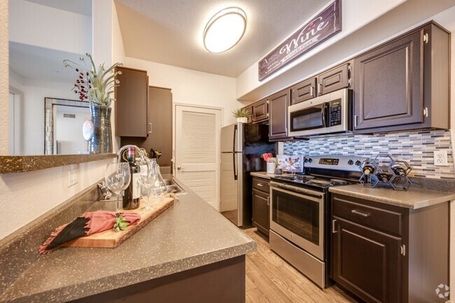
Apartment Features
Air Conditioning
Refrigerator
Tub/Shower
Oven
- Air Conditioning
- Cable Ready
- Tub/Shower
- Kitchen
- Oven
- Refrigerator
Fees and Policies
Details
Property Information
-
Built in 1997
-
65 units/2 stories
Location
Get Directions
Amenities
- Air Conditioning
- Cable Ready
- Tub/Shower
- Kitchen
- Oven
- Refrigerator
Education
| Colleges & Universities | Distance | ||
|---|---|---|---|
| Colleges & Universities | Distance | ||
| Drive: | 20 min | 11.7 mi | |
| Drive: | 25 min | 13.6 mi | |
| Drive: | 24 min | 14.9 mi | |
| Drive: | 28 min | 16.3 mi |
The Heights is within 20 minutes or 11.7 miles from MiraCosta College, Oceanside. It is also near Palomar College and USAHS.
Schools


Public Elementary School
Grades K-5
891 Students
Attendance Zone
Public Elementary, Middle & High School
Grades K-12
59 Students
Nearby
Public Elementary School
Grades K-5
474 Students
Nearby
Charter Elementary, Middle & High School
Grades K-12
384 Students
Nearby
Public Middle School
Grades 6-8
470 Students
Attendance Zone
Public High School
Grades 9-12
323 Students
Attendance Zone
Private Elementary School
Grades PK-1
Nearby
Private Elementary & Middle School
Grades K-8
7 Students
Nearby
Private Elementary, Middle & High School
Grades 1-12
27 Students
Nearby
School data provided by
 The GreatSchools Rating helps parents compare schools within a state based on a variety of school quality indicators and provides a helpful picture of how effectively each school serves all of its students. Ratings are on a scale of 1 (below average) to 10 (above average) and can include test scores, college readiness, academic progress, advanced courses, equity, discipline and attendance data. We also advise parents to visit schools, consider other information on school performance and programs, and consider family needs as part of the school selection process.
View GreatSchools Rating Methodology
View GreatSchools Rating Methodology
Transportation options available in Bonsall include Vista Transit Center, located 8.4 miles from The Heights.
| Transit / Subway | Distance | ||
|---|---|---|---|
| Transit / Subway | Distance | ||
|
|
Drive: | 15 min | 8.4 mi |
|
|
Drive: | 16 min | 8.8 mi |
|
|
Drive: | 15 min | 9.1 mi |
|
|
Drive: | 17 min | 10.0 mi |
|
|
Drive: | 19 min | 10.7 mi |
| Commuter Rail | Distance | ||
|---|---|---|---|
| Commuter Rail | Distance | ||
|
|
Drive: | 24 min | 14.4 mi |
|
|
Drive: | 27 min | 16.3 mi |
|
|
Drive: | 32 min | 20.0 mi |
|
|
Drive: | 37 min | 25.1 mi |
|
|
Drive: | 43 min | 29.6 mi |
Time and distance from The Heights.
| Shopping Centers | Distance | ||
|---|---|---|---|
| Shopping Centers | Distance | ||
| Drive: | 4 min | 1.5 mi | |
| Drive: | 5 min | 1.9 mi | |
| Drive: | 10 min | 6.0 mi |
The Heights has 3 shopping centers within 6.0 miles, which is about a 10-minute drive. The miles and minutes will be for the farthest away property.
| Parks and Recreation | Distance | ||
|---|---|---|---|
| Parks and Recreation | Distance | ||
|
Guajome County Park
|
Drive: | 11 min | 6.4 mi |
|
Live Oak County Park
|
Drive: | 12 min | 7.4 mi |
|
Rancho Guajome Adobe
|
Drive: | 14 min | 8.3 mi |
|
Rainbow County Park
|
Drive: | 19 min | 13.3 mi |
The Heights has 4 parks within 13.3 miles, including Rancho Guajome Adobe, Guajome County Park, and Live Oak County Park.
| Hospitals | Distance | ||
|---|---|---|---|
| Hospitals | Distance | ||
| Drive: | 19 min | 11.7 mi |
The Heights is 11.7 miles and a 19 minute drive from Tri - City Medical Center.
| Military Bases | Distance | ||
|---|---|---|---|
| Military Bases | Distance | ||
| Drive: | 43 min | 21.3 mi | |
| Drive: | 50 min | 32.9 mi |
The Heights is 21.3 miles from Marine Corps Base Camp Pendleton, and is convenient to other military bases, including USMC Air Station Miramar.
You May Also Like
Similar Rentals Nearby
-
-
-
-
-
-
-
-
-
-
1 / 25

What Are Walk Score®, Transit Score®, and Bike Score® Ratings?
Walk Score® measures the walkability of any address. Transit Score® measures access to public transit. Bike Score® measures the bikeability of any address.
What is a Sound Score Rating?
A Sound Score Rating aggregates noise caused by vehicle traffic, airplane traffic and local sources
31937 Del Cielo Este
Bonsall, CA 92003
Responded To This Review