-
The Mews I
-
-
-
The Mews I
24 Clayton Blvd,
Baldwin Place,
NY
10505
2 Weeks Ago
Favorites
The Mews I

Favorites
Check Back Soon for Upcoming Availability
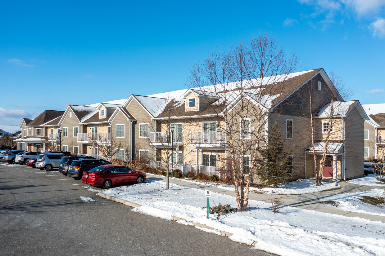
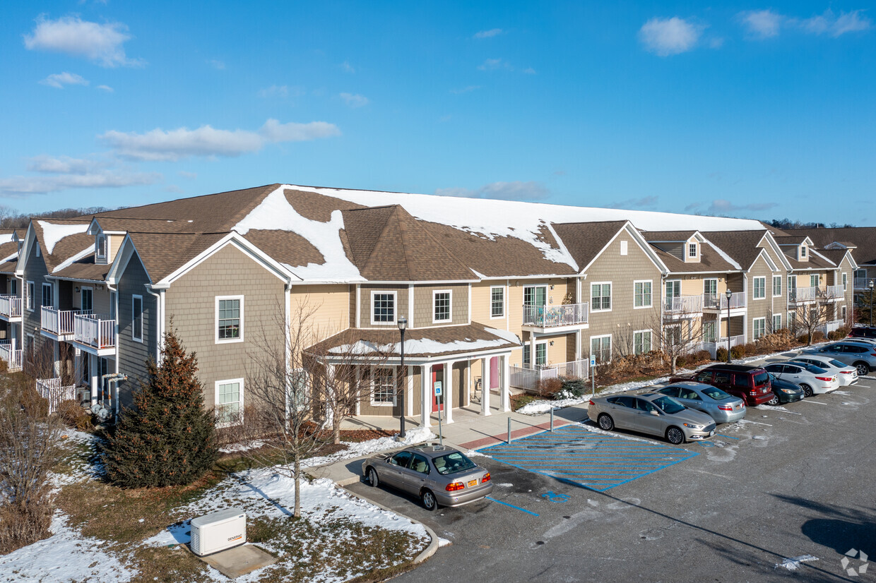
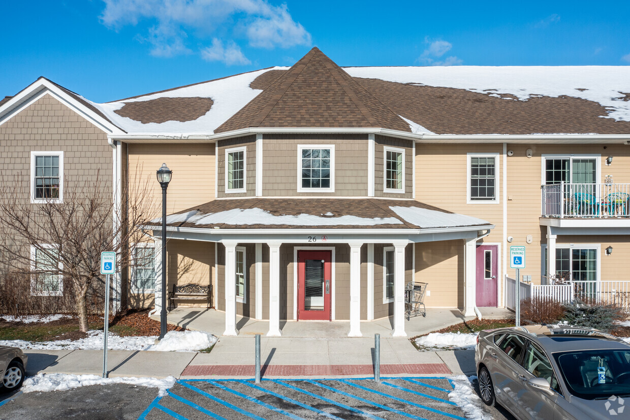
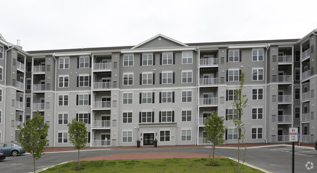
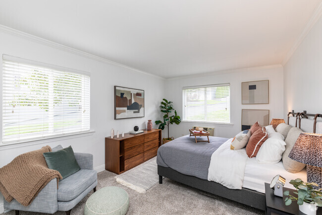
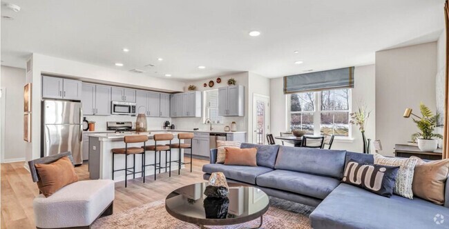
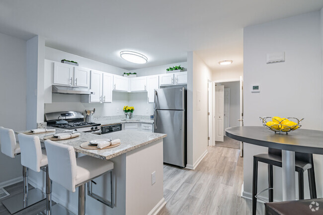
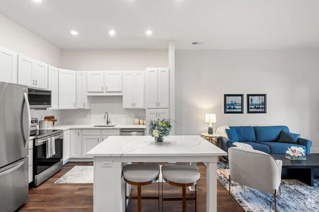
About The Mews I
Come enjoy Baldwin Place living at The Mews I. The 10505 location in Baldwin Place has so much to offer its residents. From amenities to availability, the leasing staff is ready to match you with your perfect floorplan option. Schedule a time to view the available floorplans. Visit The Mews I today.
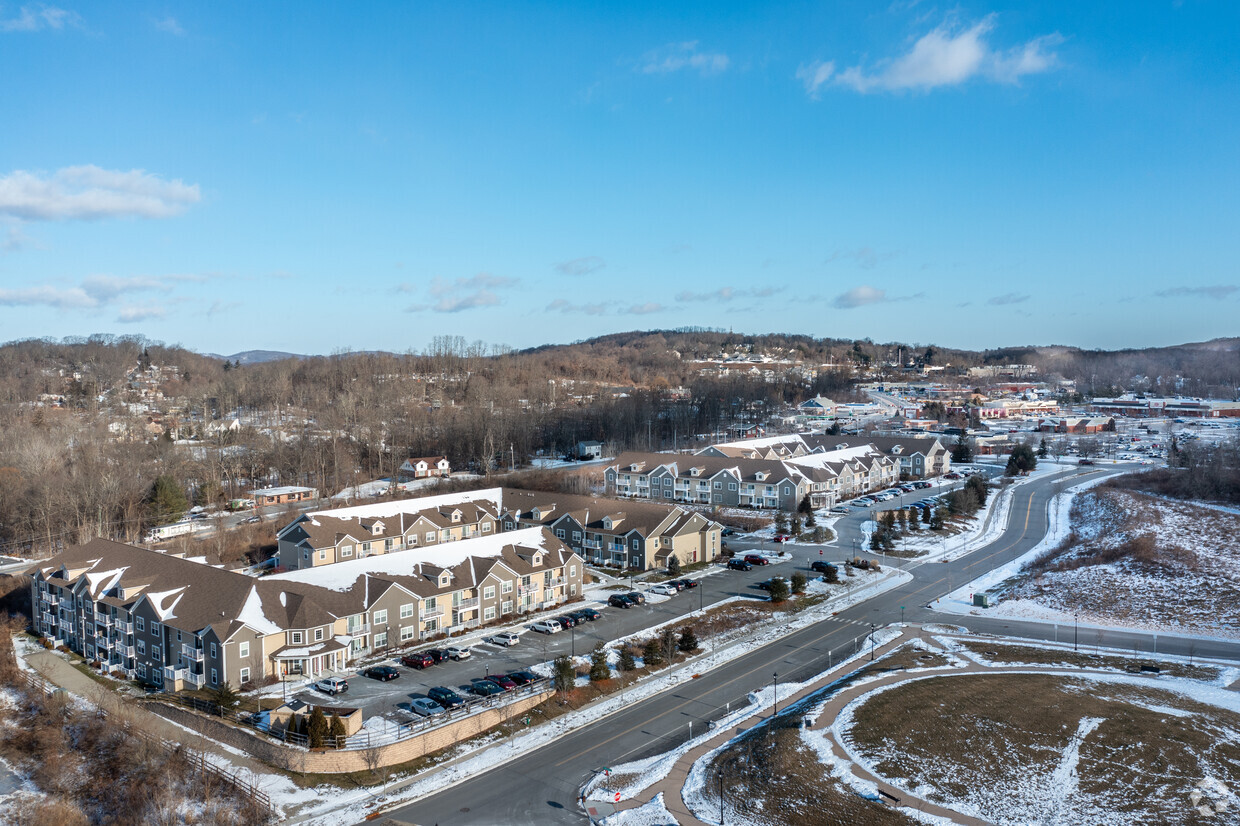
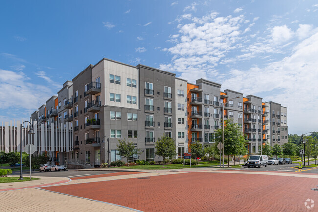
The Mews I is an apartment community located in Westchester County and the 10505 ZIP Code. This area is served by the Somers Central attendance zone.
Fees and Policies
Details
Property Information
-
Built in 2010
-
72 units/2 stories
Location
Get Directions
Education
| Colleges & Universities | Distance | ||
|---|---|---|---|
| Colleges & Universities | Distance | ||
| Drive: | 28 min | 18.8 mi | |
| Drive: | 35 min | 20.1 mi | |
| Drive: | 31 min | 20.1 mi | |
| Drive: | 39 min | 21.3 mi |
The Mews I is within 28 minutes or 18.8 miles from Pace University, Briarcliff. It is also near Pace University, Pleasantville and Western Connecticut, Westside.
Schools


Public Elementary School
Grades PK-5
433 Students
Nearby
Public Elementary School
Grades 3-5
524 Students
Attendance Zone
Public Elementary School
Grades PK-2
527 Students
Attendance Zone
Public Elementary School
Grades K-5
399 Students
Nearby
Public Middle School
Grades 6-8
569 Students
Attendance Zone
Public Middle & High School
Grades 7-12
1,254 Students
Nearby
Public Middle School
Grades 6-8
926 Students
Nearby
Public High School
Grades 9-12
980 Students
Attendance Zone
Public High School
Grades 9-12
901 Students
Nearby
Private Elementary, Middle & High School
Grades 5-12
Nearby
Private Elementary School
Grades PK-5
31 Students
Nearby
Private Middle & High School
Grades 6-10
36 Students
Nearby
School data provided by
 The GreatSchools Rating helps parents compare schools within a state based on a variety of school quality indicators and provides a helpful picture of how effectively each school serves all of its students. Ratings are on a scale of 1 (below average) to 10 (above average) and can include test scores, college readiness, academic progress, advanced courses, equity, discipline and attendance data. We also advise parents to visit schools, consider other information on school performance and programs, and consider family needs as part of the school selection process.
View GreatSchools Rating Methodology
View GreatSchools Rating Methodology
Transportation options available in Baldwin Place include 233 Street, located 37.2 miles from The Mews I. The Mews I is near Westchester County, located 24.8 miles or 35 minutes away, and New York Stewart International, located 34.2 miles or 58 minutes away.
| Transit / Subway | Distance | ||
|---|---|---|---|
| Transit / Subway | Distance | ||
|
|
Drive: | 53 min | 37.2 mi |
|
|
Drive: | 54 min | 37.7 mi |
|
|
Drive: | 52 min | 37.8 mi |
|
|
Drive: | 53 min | 38.2 mi |
|
|
Drive: | 55 min | 38.3 mi |
| Commuter Rail | Distance | ||
|---|---|---|---|
| Commuter Rail | Distance | ||
|
|
Drive: | 16 min | 7.8 mi |
|
|
Drive: | 16 min | 8.3 mi |
|
|
Drive: | 16 min | 8.7 mi |
|
|
Drive: | 16 min | 10.6 mi |
|
|
Drive: | 19 min | 12.8 mi |
| Airports | Distance | ||
|---|---|---|---|
| Airports | Distance | ||
|
Westchester County
|
Drive: | 35 min | 24.8 mi |
|
New York Stewart International
|
Drive: | 58 min | 34.2 mi |
Time and distance from The Mews I.
| Shopping Centers | Distance | ||
|---|---|---|---|
| Shopping Centers | Distance | ||
| Walk: | 4 min | 0.2 mi | |
| Walk: | 10 min | 0.6 mi | |
| Walk: | 11 min | 0.6 mi |
The Mews I has 3 shopping centers within 0.6 mile, which is about a 11-minute walk. The miles and minutes will be for the farthest away property.
| Parks and Recreation | Distance | ||
|---|---|---|---|
| Parks and Recreation | Distance | ||
|
Chamber of Commerce Park
|
Drive: | 6 min | 2.8 mi |
|
Danner Family Preserve
|
Drive: | 7 min | 3.4 mi |
|
Lasdon Park and Arboretum
|
Drive: | 13 min | 7.1 mi |
|
Franklin D. Roosevelt State Park
|
Drive: | 11 min | 7.3 mi |
|
Muscoot Farm
|
Drive: | 14 min | 9.7 mi |
The Mews I has 5 parks within 9.7 miles, including Chamber of Commerce Park, Danner Family Preserve, and Franklin D. Roosevelt State Park.
| Hospitals | Distance | ||
|---|---|---|---|
| Hospitals | Distance | ||
| Drive: | 18 min | 8.5 mi | |
| Drive: | 15 min | 8.8 mi | |
| Drive: | 20 min | 13.5 mi |
The Mews I has 3 hospitals within 13.5 miles, the nearest is Putnam Hospital Center which is 8.5 miles away and a 18 minute drive.
| Military Bases | Distance | ||
|---|---|---|---|
| Military Bases | Distance | ||
| Drive: | 21 min | 12.5 mi | |
| Drive: | 43 min | 23.2 mi |
The Mews I is 12.5 miles from Camp Smith NY State Military, and is convenient to other military bases, including West Point Military Reserve.
You May Also Like
Similar Rentals Nearby
What Are Walk Score®, Transit Score®, and Bike Score® Ratings?
Walk Score® measures the walkability of any address. Transit Score® measures access to public transit. Bike Score® measures the bikeability of any address.
What is a Sound Score Rating?
A Sound Score Rating aggregates noise caused by vehicle traffic, airplane traffic and local sources
Responded To This Review