6326 W Buckskin Trail

Phoenix, AZ 85083 Deer Valley

Today
Share Listing
Favorites
602-390-3999
  • Monthly Rent

    $2,450

  • Bedrooms

    4 bd

  • Bathrooms

    3 ba

  • Square Feet

    2,542 sq ft

Details

$2,750 deposit, Available Dec 29
* Price shown is base rent and may not include non-optional fees and utilities. Price, availability, fees, and any applicable rent special are subject to change without notice.
* Square footage definitions vary. Displayed square footage is approximate.
6326 W Buckskin Trail
Share Listing
Favorites

About This Property

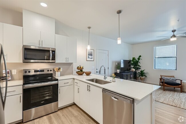
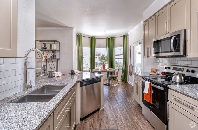
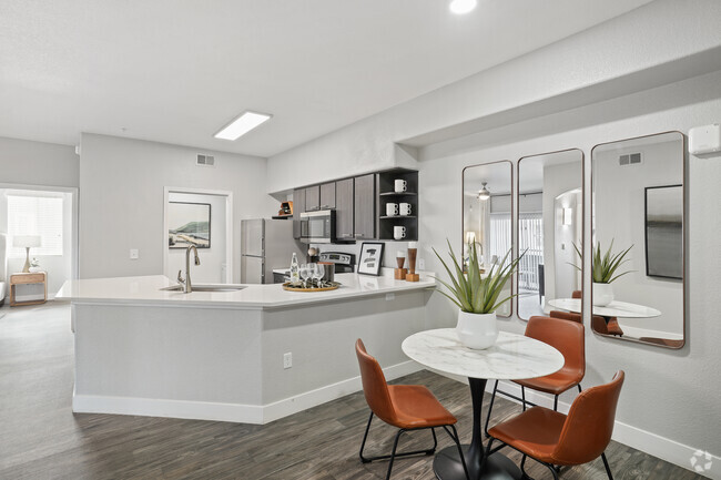
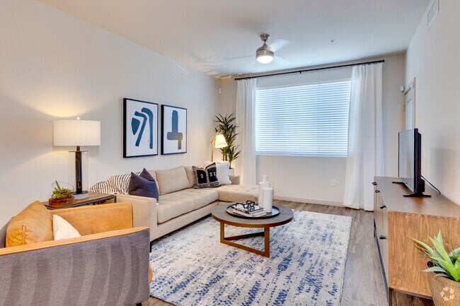
Lovely and Spacious 4 bedroom home in mountainside subdivision*Majestic Mountain views from the backyard,especially from the HUGE upstairs master bedroom and walk out deck*Open floor plan with fireplace in family room,open to kitchen and breakfast room*Wood and Tile floors*Granite counters and rich cabinetry*Large,formal dining room*Great location,can walk to multiple grocery stores/restaurants/etc.*Beautiful/green/lush landscaping complete the Picture*Large/grass backyard with those mountain views*

6326 W Buckskin Trail is a house located in Maricopa County and the 85083 ZIP Code. This area is served by the Deer Valley Unified District attendance zone.

Contact

William D Matthews
west usa realty
Arizona Regional MLS
Copyright 2024 Arizona Regional MLS. All rights reserved. Information is deemed reliable but not guaranteed.
Location
Property Address: 6326 W Buckskin Trail, Phoenix,
AZ 85083
Get Directions
This Property Available Property
Neighborhood

Deer Valley is a family-friendly suburb and residential neighborhood that’s constantly evolving. There are abundant outdoor recreational opportunities in Deer Valley because of its proximity to several natural attractions like Deem Hills and Cave Buttes, both known for scenic hiking and mountain biking trails. Residents have easy access to abundant shopping opportunities without having to leave town at places like Deer Valley Towne Center and Bell Towne Plaza. Deer Valley is home to good public schools and is the ideal suburb for those commuting to Downtown Phoenix and beyond, located less than 20 miles south of town along Interstate 17.

Learn more about living in Deer Valley 
Education
Colleges & Universities Distance
Walk: 17 min 0.9 mi
Drive: 12 min 5.0 mi
Drive: 17 min 8.0 mi
Drive: 20 min 10.0 mi
6326 W Buckskin Trail is within 17 minutes or 0.9 mile from Glendale C.C., North Campus. It is also near Midwestern University and Thunderbird, West Campus.
Schools
Public Elementary School
Grades PK-6
476 Students
Attendance Zone
9
Out of 10
Public Middle & High School
Grades 7-12
2,771 Students
Attendance Zone
9
Out of 10
Public Middle School
Grades 7-8
899 Students
Attendance Zone
8
Out of 10
Private Elementary, Middle & High School
Grades PK-12
Nearby
Private Elementary & Middle School
Grades PK-8
Nearby
Transportation

Transportation options available in Phoenix include 19Th Ave/Dunlap, located 15.9 miles from 6326 W Buckskin Trail. 6326 W Buckskin Trail is near Phoenix Sky Harbor International, located 30.2 miles or 43 minutes away.
Transit / Subway Distance
Drive: 23 min 15.9 mi
Drive: 25 min 16.9 mi
Drive: 25 min 17.6 mi
Drive: 27 min 18.7 mi
Drive: 29 min 19.9 mi
Airports Distance
Airports Distance
Phoenix Sky Harbor International
Drive: 43 min 30.2 mi
Somewhat Walkable
59
Walk Score®
Out of 100
You might be able to get out and walk when living in this area. Some errands can be accomplished on foot, but for others you’ll need a car.
Minimal Transit
0
Transit Score®
Out of 100
Somewhat Bikeable
46
Bike Score®
Out of 100
You might be able to find places to ride your bike in this area, but you’ll most likely want your car for most errands.
-
-
Soundscore
Out of 100

Traffic:

-

Airport:

-

Businesses:

-

Score provided by

Scores provided by  and

Score provided by

Points of Interest

Time and distance from 6326 W Buckskin Trail.

Shopping Centers Distance
Walk: 7 min 0.4 mi
Walk: 9 min 0.5 mi
Drive: 5 min 2.4 mi
6326 W Buckskin Trail has 3 shopping centers within 2.4 miles, which is about a 5-minute drive. The miles and minutes will be for the farthest away property.
Parks and Recreation Distance
Deem Hills Recreation Area
Drive: 3 min 1.6 mi
Adobe Dam Regional Park
Drive: 7 min 3.8 mi
Challenger Space Center
Drive: 8 min 4.7 mi
Paseo Highlands Park
Drive: 9 min 4.9 mi
Adobe Mountain Park
Drive: 12 min 6.3 mi
6326 W Buckskin Trail has 5 parks within 6.3 miles, including Deem Hills Recreation Area, Adobe Dam Regional Park, and Paseo Highlands Park.
Hospitals Distance
Hospitals Distance
Drive: 9 min 4.7 mi
Drive: 14 min 8.6 mi
Drive: 17 min 8.9 mi
6326 W Buckskin Trail has 3 hospitals within 8.9 miles, the nearest is Arrowhead Hospital which is 4.7 miles away and a 9 minutes drive.
Military Bases Distance
Drive: 28 min 19.3 mi
Drive: 44 min 30.1 mi
Drive: 109 min 82.3 mi
6326 W Buckskin Trail has 3 military bases within 82.3 miles, the nearest is Luke Air Force Base which is 19.3 miles away and a 28 minutes .

You May Also Like